
Point cloud surveying, a cutting-edge technology, has revolutionised the world of architectural and construction surveying. In this blog, we'll delve into the intricacies of point cloud surveying, its advantages over traditional surveying methods, the level of accuracy it offers, and its cost implications.
What does point cloud surveying mean?
Point cloud surveying begins with the creation of a point cloud—a digital representation of a physical object or space. This point cloud consists of countless data points in a 3D coordinate system.
These points are generated by high-precision laser scanners that capture the shape, size, and spatial characteristics of the surveyed area. Think of it as creating a virtual 3D model of a building or environment, but with an incredible level of detail.
One of the standout features of point cloud surveying is its ability to record structures and spaces with an extraordinary level of detail.
Traditional methods like tape measuring or laser measuring devices may struggle to capture complex shapes or intricate architectural elements.
In contrast, point cloud surveys leave no stone unturned. They can precisely capture everything from the grandeur of a cathedral's arches to the intricacies of an historical building's ornate detailing.
One significant advantage of point cloud surveys is their compatibility with conventional architectural planning and design processes. The data captured in a point cloud can be seamlessly integrated into Computer Aided Design (CAD) software, making it easier for architects and designers to create accurate and detailed architectural plans. This means that point cloud surveys not only provide highly detailed data but also simplify the subsequent design phases, reducing the chances of errors and discrepancies.
Why would I use a point cloud survey over other forms of surveying?
Traditional surveying methods, including tape measurements and laser scanning, have their limitations. They are often slower and less accurate when it comes to capturing intricate details or irregular shapes, which are abundant in traditional Cornish properties.
This can lead to inaccuracies in measurements, which can be problematic in architectural and construction projects where precision is paramount.
Point cloud surveying offers a significant advantage in terms of efficiency. Unlike traditional methods that require time-consuming manual measurements, point cloud scanners can quickly and accurately capture a vast amount of data in a relatively short period. This not only saves time on site but also reduces the risk of human error in data collection.
One of the standout features of point cloud surveys is their ability to capture an astonishing level of detail. These scanners can pick up even the smallest architectural features, ensuring that nothing is overlooked. This level of detail can be crucial in projects where historical preservation or intricate design elements are essential.
Another impressive aspect of point cloud surveying is its speed. With modern scanning equipment, each scan can be completed in as little as 20 seconds. This rapid data acquisition allows for efficient and cost-effective surveying, reducing the time spent on-site and minimising disruptions to ongoing projects.
Point cloud scanners go beyond capturing mere dimensions. They can also capture 360-degree photographs and color information, adding an additional layer of visual context to the survey data. This not only enhances the quality of the survey but also provides valuable visual references for architects and builders during the design and construction phases.
How accurate is a point cloud survey?
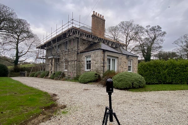
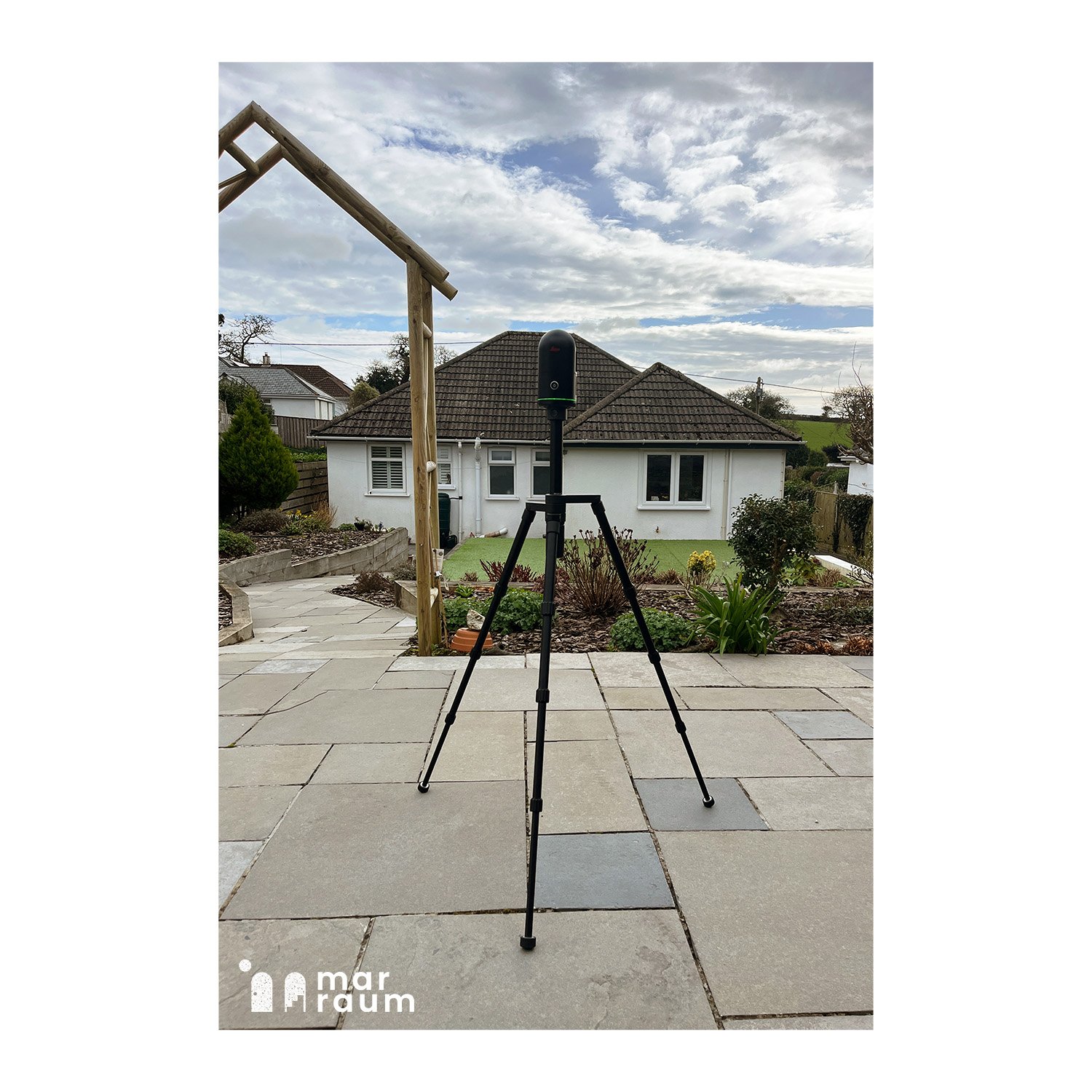
The accuracy of a point cloud survey primarily depends on the quality of the scanning equipment used. High-quality scanners, such as the Leica BLK 360 we use at Marraum, offers remarkable precision.
These scanners are designed to minimise errors and provide highly accurate data, ensuring that the resulting point cloud faithfully represents the surveyed environment.
To put this accuracy into perspective, the Leica BLK 360 scanner can capture details with an astonishing precision of 4mm at a distance of 10 meters. This level of accuracy makes point cloud surveying a valuable tool in various industries, including architecture, engineering, and construction, where precision is critical.
Unlike traditional surveying which may miss certain details or make errors during manual measurements, point cloud scanners capture exactly what they "see." This means that even the tiniest architectural features, such as intricate mouldings or irregular surfaces, are faithfully reproduced in the point cloud data, ensuring a comprehensive and precise representation of the surveyed space.
The accuracy of a point cloud survey can also be enhanced by increasing the number of scans taken on-site. By conducting multiple scans from different angles and positions, the resulting point cloud becomes more comprehensive and detailed.
This approach is particularly useful in large or complex projects where precision is of utmost importance.
How much does a point cloud survey cost?
The cost of a point cloud survey can vary depending on several factors. One of the primary factors is the size of the property or area being surveyed. Larger properties or complex environments may require more time on-site, leading to higher surveying costs.
While point cloud surveying may have upfront costs, it can result in significant savings during the subsequent design and planning phases. The highly accurate data provided by point cloud surveys can reduce the time spent on creating architectural plans and drawings. This efficiency can lead to cost savings in the long run.
It's essential to consider the cost of the scanning equipment when evaluating the overall cost of a point cloud survey. High-quality scanners can be expensive, and these costs are often factored into the surveying fees. However, the benefits of increased accuracy and efficiency often outweigh the initial investment in equipment.
One crucial aspect to consider is the risk reduction associated with accurate surveys. Point cloud surveys help identify potential issues or conflicts in the early stages of a project, reducing the risk of costly errors and delays during construction. This risk mitigation can ultimately save both time and money on-site.
In conclusion, point cloud surveying represents a remarkable leap forward in the field of architectural and construction surveying. It offers unparalleled accuracy, efficiency, and detail capture, making it a valuable asset for professionals in various industries.
While the cost of point cloud surveys may vary, the long-term benefits, including reduced drawing time and on-site risk mitigation, make it a compelling choice for anyone looking to achieve precise and comprehensive survey data.
If you're ready to experience the advantages of point cloud surveying for your project, don't hesitate to get in touch with us.